Australia storm brings severe weather and flood risk
A large multi-state storm brought severe thunderstorms and flood risk to eastern Australia, with more expected.
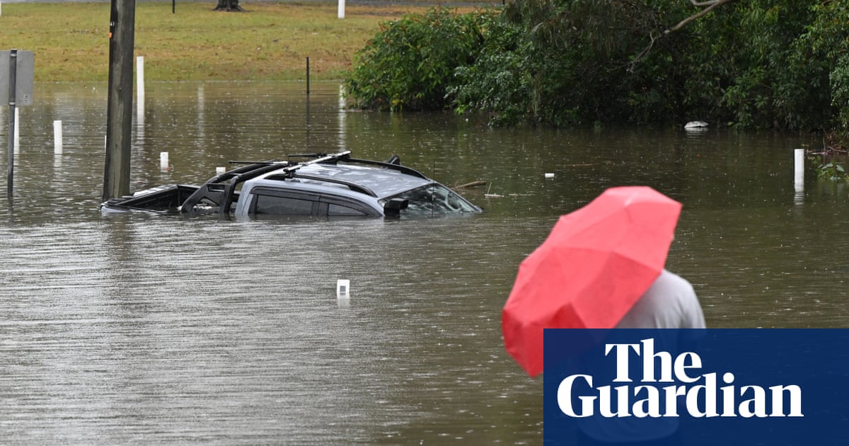
At a glance
- A large multi-state storm brought severe thunderstorms and flood warnings to eastern Australia.
- The Bureau of Meteorology warned of hail, damaging winds, flash flooding and power risks.
- Eight flood warnings were in place across southern Queensland, with more storms expected.
Large parts of eastern Australia were put on alert for severe thunderstorms on Sunday afternoon, as a broad multi-state storm system brought hail, damaging winds, flash flooding and power outage risks across several states. The Bureau of Meteorology issued a severe thunderstorm warning for Sydney, greater Wollongong and parts of the Blue Mountains, Hawkesbury, Gosford, Wyong, Wollondilly and Wingecarribbe areas.
The Bureau said the warning covered storms expected in southern Queensland, western New South Wales, the ACT and eastern Victoria. It said a broad line of storms had already swept through western New South Wales, while eight flood warnings were in place across southern Queensland after days of heavy rain.
Severe thunderstorms were likely over a huge area on Sunday afternoon, the Bureau said, including the possibility of hail, damaging winds, flash flooding and power outages.
On Sunday around midday, the Bureau recorded wind gusts reaching 100km/h in central western New South Wales.
Bureau meteorologist David Crock said the storm system was unusually large and multi-state. He said an area of high pressure had been sitting over the Tasman Sea for about 10 days and had been blocking weather fronts, bringing storms and rain to southern Queensland.
A front of cooler air moved from the west on Sunday afternoon, dragging in tropical moisture from the north and bringing storm conditions to central parts of New South Wales and Canberra. Crock said a big line of storms extended from the Snowy Mountains to the Queensland border, and that officials were watching for another band to develop behind it.
Storm activity was likely to continue through Sunday evening and into Monday in northern New South Wales and southern Queensland as the cold front pushed forward. Crock said Monday was the last big impact of the system and would bring relief to south-east Queensland.
The Bureau said some eight flood warnings were in place over southern Queensland. The Mary River downstream of Gympie was forecast to reach major flood levels in Tiaro on Sunday evening and into Monday.
After a very dry September, southern parts of Queensland saw October rainfall that was multiple times their average, with areas around the Sunshine Coast receiving between 200mm and 400mm of rain in the past week.
The Bureau’s long-range forecast for November to January suggests rainfall is likely to be above average over most of the country except the far north and much of Tasmania. November is likely to be warmer than usual for the southern half of the continent, with night-time temperatures forecast to be well above average.
Global heating has seen Australia warm by about 1.5C since 1910, the Bureau’s long-term climate data shows.
Source: The Guardian.
Questions and answers
- What is happening in Australia right now?
- Large parts of eastern Australia were on alert for severe thunderstorms, with hail, damaging winds, flash flooding and power outage risks. More storms and flood risk were possible for Monday.
- How severe are the storms in Australia?
- The Bureau of Meteorology issued a severe thunderstorm warning for parts of Sydney and New South Wales, and warned of wind gusts up to 100km/h. Eight flood warnings were in place in southern Queensland.
- What caused the storm in Australia?
- Bureau meteorologist David Crock said a multi-state system was unusually large and linked to a high pressure blocking pattern over the Tasman Sea. A cooler front later brought tropical moisture.